
Site Aerial Inspections
Enhance your site management and assessment processes with our cutting-edge drone aerial inspection services. By deploying state-of-the-art drones equipped with high-resolution cameras, we offer comprehensive views of your project sites from above, providing detailed imagery and data crucial for precise mapping and progress monitoring. Our drone inspections increase safety by accessing hard-to-reach areas, significantly reducing risk and overhead costs. Whether it's construction, real estate, or infrastructure projects, our aerial inspection services ensure that you get accurate, timely, and actionable insights to streamline your operations and support decision-making with the highest level of efficiency.
SERVICES
Stakeholder Deliverables
|
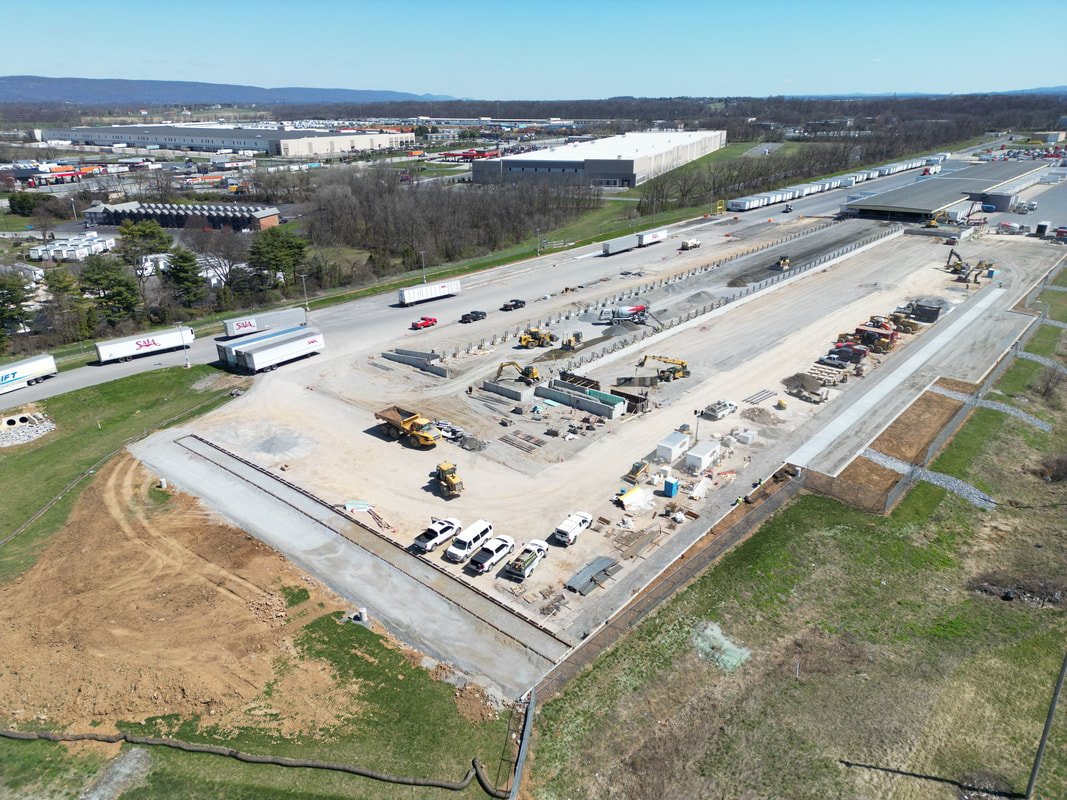
We provide essential stakeholder deliverables, such as high-resolution photos and videos, enabling property owners and project managers to visually track progress and assess site conditions. These rich media assets are instrumental for engaging and informing all stakeholders, offering a transparent and detailed view of developments at every stage of the project.
|
Seamless Workflow Integration for Aerial Site Data
|
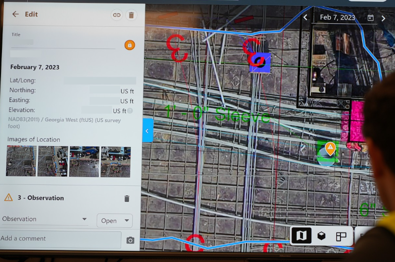
Through our partnership with DroneDeploy, we provide an enhanced service experience by offering direct web access to aerial site data and seamless integrations with project management tools such as Procore and Autodesk. This collaboration allows for real-time data sharing and streamlined workflows, enabling teams to access, analyze, and collaborate on aerial imagery and insights directly through their preferred platforms. Whether you're in the office or on the field, our solutions ensure that vital project information is at your fingertips, facilitating efficient project tracking and decision-making.
|
Geo-Referenced Overlays

|
Utilizing an RTK (Real-Time Kinematic) module on our drones, we achieve accuracy to 2 inches in aerial imagery, perfectly aligning with your geo-referenced plans. This precision enables seamless overlays of aerial shots onto existing site plans, ensuring that every detail is captured and aligned with exact coordinates.
|